camzappersTo the globe

Signal#2948Road

I-10 : (541) West of Eagle Mountain Rd

Desert Center, United States of America
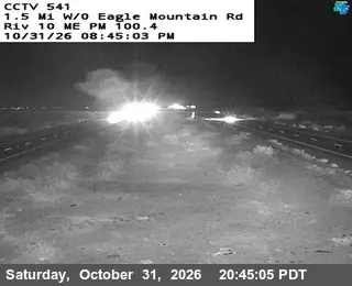
Latest image of I-10 : (541) West of Eagle Mountain Rd
Image from quickmap.dot.ca.gov

Watch live at quickmap.dot.ca.gov ↗On the globe

I-10 : (541) West of Eagle Mountain Rd is a public webcam in Desert Center, United States of America, viewable at quickmap.dot.ca.gov. Desert Center has 1 other cam on Camzappers. The nearest other cam is I-10: (389) W/O EAGLE MOUNTAIN RD, 2 km away.

Place
Desert Center
Country
United States of America
Continent
North America
Type
Road
Image
the owner's still image
Found via
Caltrans
Coordinates
33.6954, -115.4845

Nearby

  1. Latest image of I-10 : (533) West of Cottonwood Springs RoadI-10 : (533) West of Cottonwood Springs RoadSignal · 35 km
  2. Latest image of I-10 : (535) Chiriaco SumitI-10 : (535) Chiriaco SumitSignal · 26 km
  3. Latest image of I-10 : (538) East of Hayfield RoadI-10 : (538) East of Hayfield RoadSignal · 12 km
  4. Latest image of I-10 : (544) East of Route 177I-10 : (544) East of Route 177Signal · 14 km
  5. Latest image of I-10 : (547) East of Corn Springs RoadI-10 : (547) East of Corn Springs RoadSignal · 26 km
  6. Latest image of I-10: (389) W/O EAGLE MOUNTAIN RDI-10: (389) W/O EAGLE MOUNTAIN RDSignal · 2 km